ALL THINGS RESEARCH
1) Geophysics of the environment
The reserach blog of Stefan Nielsen

Geophysics of the environment
Over the past few years I have added near-surface geophysics to my research.
I use geophysical tools
(equipment»,
software»)
in unconventional ways to explore archaeology, geoarchaeology,
uderground water flow, water inflitration in historical monuments
and other environmental issues.
Living, working and leading student field trips
in the North East and in the Lakes district, with their rich historical,
prehistorical and natural backgroung, opened for me a myriad of
opportunities to explore what is under our feet in everyday's
life. What with Hardrian's wall, the ultimate frontier of the Roman empire.
Aand those who dwelled on these hills before (bronze age) and after (medieval)?
Arriving here straight from Rome where I lived for more than ten years
it feels like I am not so far from home after all with all these ancient stones.
But here the artifacts are mostly underground. We need to dig, or... use geophysics!
Also, you' be right to ask, with all this rain where does the water go??
Not so easy, mate! Yes there are rivers, and streams, and man-made drains
but there are also mysterious underground channels and flows through the dirt
and water sinking in and pouring out of the ground further astray... And
loads of abandoned coal mines that are flooded with water, too.
Now how about that mine water, is it warm? Sure enough it's warmer than
the chilling air at these latitudes in the winter, so part of that relative heat can
be extracted with heat pumps and used to warm up houses or greenhouses or malls...
Wait a miniute, now we're talking about geothermal energy! And we're not even close to Iceland.
Is this a thing? It is and you can find more on this at THE GEMS PROJECT
The rain (yes, again!) also falls on buildings, roads and bridges. Some of them are historic stone-made
monuments. The water always finds its way, even through masonery structures, if they are ageing and not well conserved.
If we can make a topmographic image of underground water paths with geophysics, why can't we image the
water paths through buildings? It turns out that I tried this out with the help of students and colleagues
and you can see some results at PREBENDS BRIDGE.
And as far as being up to our elbows in the mud with all the recent rain,
we might as well go all the way. That's why we decided with a group of students
to inspect a breached dam as part of their field trip.
Keep posted
for more geophysics soon to come with ventures in archaelogy, flooded grazing fields and the
search for a lost dam buried in the sandy loams of an estuary...
Prebends bridge
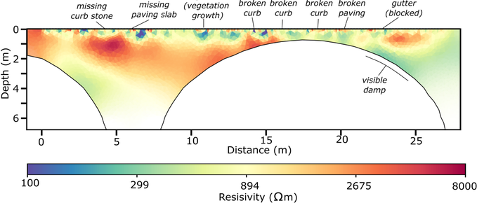
Imaging the damp pathways inside a masonry historical monument May 2024

Electrical Resitivity Tomography (ERT) works on soil, bedrock, and even on
tree trunks and
standing trees.
Then why not on man-made stone structures like historical bridges? I was up to the challenge
but short of time, until I found a student how was willing to spend hours on the bridge in the cold rain
for their 3rd year project...
Then again another student who applied for my project under the
NERC Research Experience Placement Program.
The challenge was that we could not drill the bridge to plant electrodes inside, but had to find
a non-destructive way.
We used both medical sticky pads and some specially-made aluminum plate
electrodes the I designed and that work quite well by applying a conductive gel between the surface
and the electrode plate.
Imaging was obtained by modelling electric current on a numercial mesh
with the shape of the bridge and performing an inverse problem with the help of the
pygimli open source software library.
The results are in press on Journal of Architectural Conservation and a preprint
of the manuscript will be soon available here
with details of the method used.
The breached dam: this was muddness!
Again we used ERT, but also the seismic refraction method, to track the the breach at the base of a dam and the water pathways May 2024
The Castle: not the Kafka novel, but ...
... installing ERT in the search of an ancient moat, long lost to the mysteries of medieval times. T'was a bright sunny day and a small swarm of geophysics enthusiast was spotted frolicking in the spring grass with their favourite toys (electrodes, cables and computers). May 2024
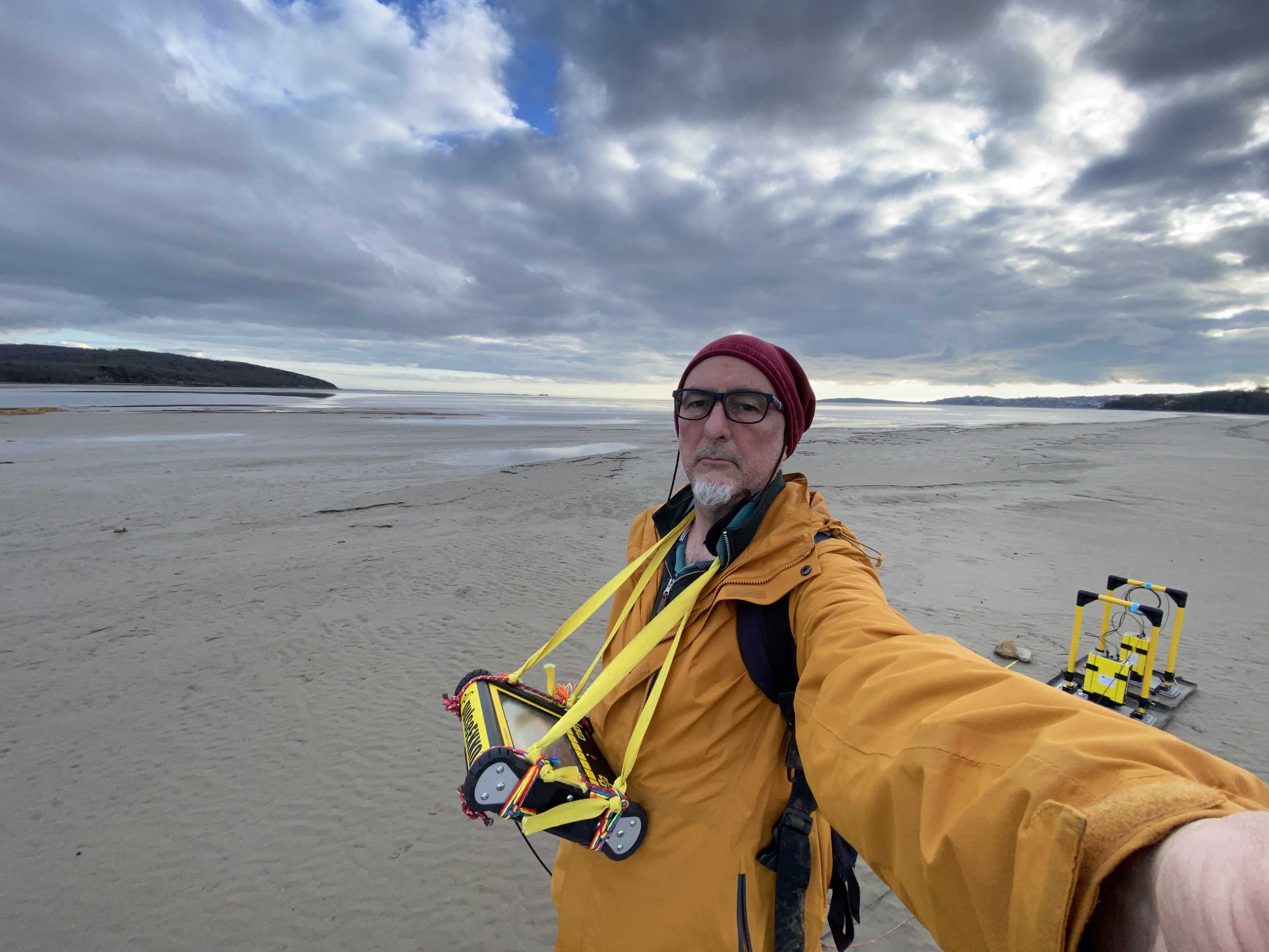
Looking for the lost dam in the sandy loams using GPR May 2024
Although the skyes and the estuary views in the Lakes district are also amazing...
